
A State Department of Transportation (DOT) Has Entered Into A Formal Contractual Agreement To Evaluate ProStar’s PointMan
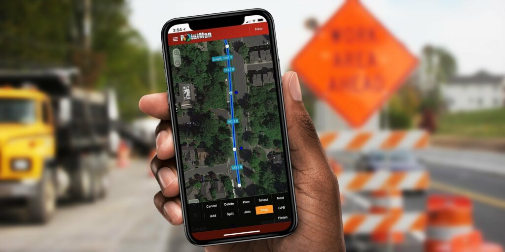
A State Department of Transportation (DOT) Has Entered Into A Formal Contractual Agreement To Evaluate ProStar’s PointMan Tuesday, July 15, 2025, at 7:058 AM EST TSX Venture Exchange Trading Symbol: MAPS OTCQXTrading Symbol: MAPPF A State Department of Transportation (DOT) Has Entered Into A Formal Contractual Agreement To Evaluate ProStar’s PointMan GRAND JUNCTION, Colo., July […]
Integration of Geoidal Models into PointMan – Altitude Referencing
The survey and engineering worlds have various methods of determining the height of a point on the ground surface. In the same manner as horizontal coordinates having different datums so do vertical coordinates.
PointMan and Trimble Catalyst
By: Peter Srajer, CLS, P. Eng. and Benjamin Skogen, CPM Summary Trimble Catalyst is a software based GNSS receiver as opposed to the use of the dedicated processors and firmware programming that is on board a conventional hardware receiver. The Trimble Catalyst uses the DA1 antenna and processing power of a compatible mobile device to […]
PointMan Now Supports Geoidal Models
By: Peter Srajer, CLS, P. Eng. and Benjamin Skogen, CPM Synopsis of Issue The survey and engineering worlds have various methods of determining the height of a point on the ground surface. In the same manner as horizontal coordinates having different datums, so do vertical coordinates. There are three surfaces we are concerned with in […]
Snapping Linework to Potholes in the Field
Advantages of Snapping Linework to Points