By Pulkit Chaudhary
Daily tons of utility location data is produced all across the globe but its effective management is among the biggest challenge that stakeholders continue to face.
“In the United States and throughout the world, government agencies are looking for a system that can serve as a centralized database which can take all of this data that’s currently available and manage it on one single platform and then provide the ability to share that data whenever its needed by the various stakeholders including whenever it is updated or when any discrepancies are found,” said Mr. Page Tucker, CEO ProStar Geocorp, Inc., during a recent discussion with Geospatial Media and Communications.
Several initiatives have been witnessed especially in developed economies such as the U.S., U.K, Singapore, and the Netherlands where they are developing a central platform to collate and visualize the subsurface utility infrastructure. One such data management initiative is that of the Colorado Department of Transport (CDOT).
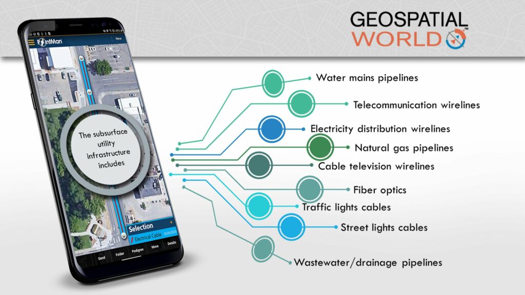
CDOT is among the few transport organizations all across the globe that is providing Quality Level B information of the subsurface utility infrastructure to its construction contractors in the bidding stage of any new construction project. Using Prostar’s Pointman and Transparent Earth solutions, they are digitizing results obtained during SUM operation and also ensuring that if a new subsurface infrastructure is being built, its as-builds are also being uploaded on the SaaS platform.
Mr. Page’s comments on the same were: “So in working with CDOT our goal was to create a system that can improve the current management practices of all their assets both above ground and below ground as well as other utility owners that place their assets on CDOT’s right of ways. The system would also be required to integrate into their current systems of record and also into the systems of record of the stakeholders that have assets on CDOT’s right-of-way and that provide services. This includes all the municipalities, utility owners, the pipeline companies as well Colorado 811 and the service contractors. As our population growth continues and demand for new utilities increases, their right of ways are becoming congested. An example is telecom networks such as fiber optic, which are being put into the ground at a very significant rate and required to cross over current utility networks. CDOT implemented our solution so that they can identify precisely where the current assets are located on their right of way and where these new installations are being placed so that they can improve all the business practices associated to the management of this infrastructure as well as prevent damages to it that occur far too often.
Read the full article here at Geospatial World